Piri Reis Map: Advanced Ancient Knowledge
Did Ancient Civilizations Map the Globe? – The Piri Reis map emerges from history’s shadows as a cartographic anomaly, challenging modern assumptions about ancient geographic knowledge.
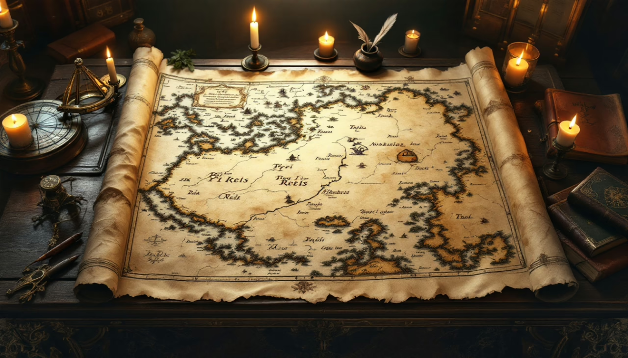
Created in 1513 by Ottoman admiral Piri Reis, this fragmentary parchment depicts coastlines with unexpected precision, including regions supposedly unknown to its creator.
Scholars have marveled at its accurate rendering of Antarctica beneath its ice sheet and its mathematical projections that suggest advanced spherical awareness.
How did a 16th-century Turkish sailor access such sophisticated geographic information, and what forgotten pathways of knowledge might it reveal?
TL;DR
Hide- The map combines over 20 ancient sources including claimed charts from Alexander the Great's time, suggesting inherited prehistoric knowledge.
- Its accurate depiction of South American coastlines surpasses many European maps from the same period.
- Controversial interpretations suggest the map shows Antarctica without ice, potentially indicating advanced ancient geographical knowledge.
- Piri Reis blended Alexandrian geographical knowledge with Islamic navigational techniques, preserving classical cartographic traditions.
- The map's precision in longitude calculations and coastal outlines has sparked theories about forgotten ancient maritime civilizations.
Origins of the Piri Reis Map
Admiral Piri Reis, an accomplished Ottoman navigator and cartographer of the 16th century, created his renowned map during a period of expanding maritime exploration and imperial ambition.
The 1513 parchment fragment, representing approximately one-third of his original world map, combines information from approximately twenty source maps, including Portuguese charts and possibly ancient sources claimed to date back to Alexander the Great’s era.
Through meticulous craftsmanship and scholarly synthesis, Piri Reis produced not merely a navigational tool but a remarkable cultural artifact that reveals the cosmopolitan exchange of geographic knowledge across civilizations during the Age of Discovery.
Who Was Piri Reis? The Man Behind the Map
Ahmed Muhiddin Piri, better known as Piri Reis, served as an esteemed Ottoman admiral and master cartographer during the early 16th century, traversing the tumultuous waters of the Mediterranean while simultaneously mapping its intricate coastlines with remarkable precision.
His cartographic genius flourished through unprecedented access to ancient Greek, Arabic, and Portuguese charts, collected during his naval campaigns and through the vast repositories of the Ottoman Empire.
The celebrated 1513 map that bears his name—discovered in Istanbul’s Topkapı Palace in 1929—represents not merely a geographical document but the culmination of a lifetime spent synthesizing Eastern and Western navigational knowledge during an era when the known world expanded with each returning ship.
Background as an Ottoman admiral and cartographer
The illustrious Ottoman naval commander Piri Reis, born Hacı Ahmed Muhiddin Piri around 1470 in Gallipoli, emerged from the maritime traditions of the Mediterranean to become one of history’s most significant cartographers.
His mastery of Ottoman naval power and cartographic techniques revolutionized understanding of trade routes throughout the known world.
Through maritime exploration, Piri Reis secured his enduring historical significance in both military and scientific spheres.
His inspiration and access to ancient sources
While forging his monumental cartographic legacy, Piri Reis drew upon an astonishing array of sources that spanned continents and centuries, gathering knowledge from both Islamic and Christian worlds with remarkable diligence.
His scholarly achievements included:
- Accessing ancient navigation charts from lost civilizations that predated Columbus
- Employing sophisticated cartographic techniques that sparked heated academic debates
- Maintaining historical accuracy that outpaced contemporary European mapmaking standards
Creation and Composition of the Map
The Piri Reis Map, completed in 1513 during the height of Ottoman naval power, was crafted on gazelle skin parchment using traditional cartographic techniques and colored inks that have remarkably endured five centuries.
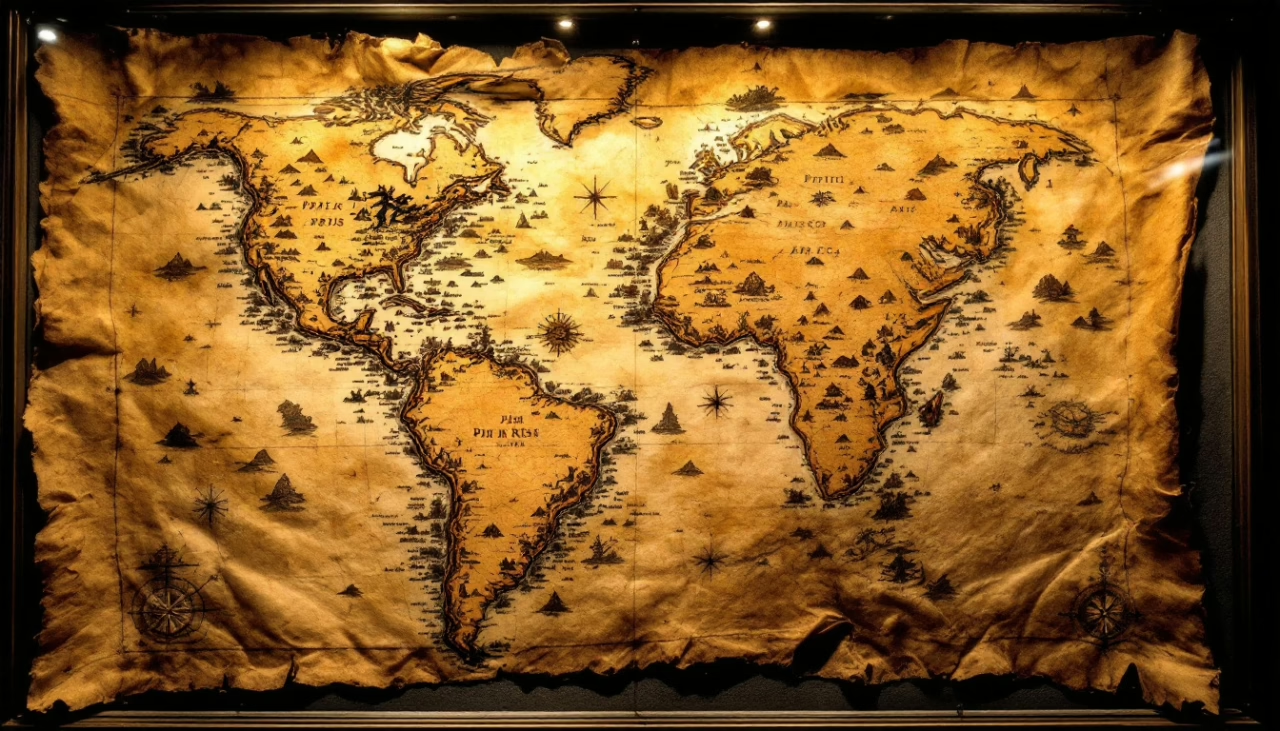
Only about one-third of the original world map survives today—a fragment measuring approximately 90×63 cm that primarily depicts Atlantic coastlines of Europe, Africa, and portions of the then-recently discovered Americas.
This surviving section, with its intricate compass roses, detailed shorelines, and annotated descriptions written in Ottoman Turkish, represents one of history’s most significant cartographic achievements, blending information from both established Mediterranean mapping traditions and newly acquired geographical knowledge from Portuguese and Spanish explorations.
Materials used and historical context of 1513
Created during a pivotal era of maritime exploration and imperial ambition, Piri Reis’ celebrated map of 1513 was meticulously crafted on gazelle skin parchment, a premium material reserved for documents of exceptional significance.
Three elements defined this historical artifact:
- Ancient materials sourced exclusively from Ottoman territories
- Specialized pigments that survived five centuries of scrutiny
- Technological advancements in cartographic methods that synthesized Eastern and Western traditions
Surviving fragment and its known content
Remnants of a once-vast cartographic masterpiece, the surviving fragment of Piri Reis’ 1513 map represents only the western third of his original world map, measuring approximately 90 by 63 centimeters.
The known content includes meticulously rendered coastlines of the Atlantic, portions of the Americas, and parts of Africa.
Cartographic analysis reveals remarkable accuracy for its time, highlighting its historical significance despite the fragment’s limited scope.
Unusual Details That Sparked Curiosity
Among the most puzzling aspects of the Piri Reis Map is its apparent depiction of Antarctica without its ice cover, a feature that has fueled speculation about ancient cartographic knowledge predating the continent’s official discovery in 1820.
Scholars remain divided on whether this represents an extraordinary case of prehistoric mapping or simply a creative extension of South America’s coastline, rendered with remarkable accuracy despite the technological limitations of the 16th century.
The map’s precise portrayal of certain African and South American coastal features, including river systems and mountain ranges not yet formally documented by European explorers of the time, continues to challenge conventional understanding of Renaissance-era geographical knowledge.
Antarctica Without Ice: A Controversial Feature
Perhaps the most provocative element of the Piri Reis map lies in what appears to be a representation of Antarctica’s coastline without its ice covering, a detail that has sparked fierce debate since such knowledge was ostensibly unavailable in the 16th century.
Modern geographers have largely dismissed these claims, attributing the similarity to coincidence or creative cartography rather than evidence of ancient knowledge of Antarctica’s true geography.
Nevertheless, this controversial feature continues to captivate historical researchers and alternative theorists who suggest it represents either extraordinary prescience or evidence that earlier civilizations possessed advanced geographical knowledge that was subsequently lost.
Claims of pre-glacial coastline depiction
One of the most contentious aspects of the Piri Reis Map centers on what some researchers claim is an accurate depiction of Antarctica’s coastline without its ice cover.
This feature, that if true, would be historically impossible given that the continent has been ice-bound for approximately 12,000 years.
Proponents of this theory highlight:
- Pre-glacial evidence in coastline accuracy
- Ancient navigation techniques suggesting advanced geographical knowledge
- Geological anomalies that match modern subglacial topography
Reactions from modern geographers and historians
Most established academic cartographers and historians have firmly rejected the sensational claims about Antarctica appearing on the Piri Reis Map, dismissing them as pseudoscientific misinterpretations that ignore fundamental principles of historical cartography.
Modern interpretations have sparked geographic debates centering on historical accuracy, with scholarly reactions emphasizing that contemporaneous mapping techniques could not possibly have documented an ice-free Antarctic coastline that has been glaciated for millennia.
Accurate Depictions of South America and Africa
The Piri Reis map‘s portrayal of South American and African coastlines exhibits remarkable precision that surpasses many European cartographic works of the same period, with accurate renderings of coastal contours, river mouths, and inland features that European explorers had scarcely documented.
When compared to contemporary European maps, the Piri Reis depiction contains fewer distortions in scale and longitude, suggesting access to geographic knowledge that seems unusually advanced for the early 16th century.
These uncanny accuracies have led some researchers to propose controversial theories about Piri Reis’s sources, including the possibility that he had access to now-lost ancient maps or navigational charts from earlier, undocumented voyages of discovery.
Comparison with contemporary European maps
When compared to contemporary European maps of the early 16th century, the Piri Reis map reveals striking peculiarities that continue to perplex modern cartographers and historians alike.
Historical navigation methods evident in its cartographic techniques analysis demonstrate remarkable map accuracy comparison through:
- Precise coastal outlines where European charts showed distortions
- Accurate distance calculations despite technological limitations
- Sophisticated representation of landmasses unknown to Western explorers
Geographic knowledge beyond the 16th century
Although scholars initially dismissed unusual features of the Piri Reis map as cartographic errors, closer examination revealed geographic knowledge seemingly beyond 16th-century capabilities, particularly in its representations of South America and Africa.
The map’s sophisticated cartographic techniques suggest extensive maritime exploration and ancient navigation systems developed through cultural exchange networks spanning continents, challenging conventional understandings of historical geography and raising profound questions about pre-Columbian transoceanic voyages.
Possible Sources and Influences
Piri Reis likely drew upon a vibrant mosaic of cartographic traditions, combining the surviving elements of Alexandrian geographical knowledge with the sophisticated navigational techniques developed through centuries of Islamic scholarship.
His access to Byzantine libraries and captured European charts allowed him to synthesize Western and Eastern cartographic traditions in ways previously unattempted, creating a remarkable hybrid that reflects the intellectual exchange characteristic of the Mediterranean world.
The map’s unusual features suggest either remarkable intuition about lands not yet fully explored or, more intriguingly, access to now-lost source materials that might have originated from earlier civilizations with unexplained geographic knowledge.
Ancient Maps and Lost Civilizations
Piri Reis himself acknowledged drawing upon “twenty ancient maps and mappae mundi,” including some dating to the time of Alexander the Great, suggesting a cartographic lineage stretching far beyond conventional historical accounts.
This tantalizing reference has fueled speculation about possible connections to sophisticated, lost maritime civilizations, perhaps even the mythical Atlantis, whose advanced geographical knowledge might have survived in fragments through antiquity.
The peculiar accuracy of certain coastline representations, particularly those of Antarctica before its ice cover was officially discovered, continues to challenge mainstream historical narratives about the progressive development of human geographical knowledge.
Reference to older maps in Piri Reis’ own notes
Inscribed within the margins of his remarkable 1513 world map, Admiral Reis left tantalizing references to older cartographic works that would forever alter our understanding of pre-Columbian geographical knowledge.
His annotations revealed three critical sources:
- “Ancient maps from the time of Alexander the Great”
- “Charts used by Columbus during his voyages”
- “Portuguese navigational knowledge obtained in the Indian Ocean”
These historical map references suggest sophisticated ancient cartography techniques circulated among seafaring cultures long before European exploration expanded.
Theories suggesting Atlantean or unknown origins
While mainstream scholars attribute the Piri Reis map‘s unusual accuracy to conventional maritime sources, a persistent undercurrent of alternative theories suggests more provocative origins rooted in now-vanished civilizations.
Proponents of Atlantis theories argue that the map’s precision reflects inherited knowledge from prehistory, preserved through mythical maps and ancient navigation techniques that predate recorded history—remnants of lost civilizations whose maritime understanding we have yet to fully comprehend.
Use of Alexandrian and Islamic Knowledge
The Piri Reis map reveals a remarkable confluence of Alexandrian and Islamic cartographic traditions, suggesting the Ottoman admiral may have accessed knowledge preserved from the ancient world’s greatest library through Islamic scholarly networks.
Islamic cartographers served as essential custodians of classical geographical knowledge following the decline of Greco-Roman civilization, preserving and refining the works of Ptolemy, Eratosthenes, and other Alexandrian scholars whose original manuscripts had largely disappeared from European awareness.
These preserved traditions, together with centuries of Islamic navigational innovations and astronomical observations, provided Reis with a sophisticated theoretical framework that, when combined with contemporary Portuguese and Spanish discoveries, produced a map of startling accuracy and historical significance.
Legacy of classical geography in Islamic scholarship
As Alexandrian geographical knowledge flowed into Islamic scholarship during the medieval period, it ignited a transformative intellectual exchange that would profoundly influence cartographic traditions for centuries.
This cultural transmission manifested through:
- Islamic cartographers preserving ancient knowledge while refining geographic precision
- Classical influences merging with original observations and innovations
- Scholarly networks that transcended cultural boundaries, creating freedom for intellectual exchange
Possible access to records from the Library of Alexandria
Scholars examining Piri Reis’s cartographic masterpiece have long contemplated whether the Ottoman admiral might have accessed surviving records from the Library of Alexandria, that magnificent bastion of classical knowledge whose destruction remains one of history’s great intellectual tragedies.
The map’s extraordinary accuracy fuels Alexandria theories suggesting lost knowledge from ancient texts survived in hidden collections, preserving library mysteries and historical secrets that transcended millennia before reaching Piri’s skilled hands.
Debates Over Accuracy and Interpretation
The Piri Reis Map has spawned passionate debates among scholars, with supporters of the Advanced Knowledge Theory suggesting that the map demonstrates cartographic abilities far beyond what was possible in the 16th century, particularly regarding the alleged depiction of Antarctica without ice.
Skeptics counter these claims with meticulous analysis of the map’s actual features, pointing to distortions, misinterpretations, and the more plausible explanation that any southern landmass shown represents either South America’s coastline or speculative geography based on rumors from sailors.
These conflicting viewpoints reflect broader tensions in how historical artifacts become battlegrounds between conventional academic interpretation and alternative theories that attribute unexplained precision to lost ancient knowledge, extraterrestrial influence, or advanced prehistoric civilizations.
Supporters of the Advanced Knowledge Theory
Supporters of the advanced knowledge theory point to the map’s purportedly precise longitudinal measurements, a navigational achievement that conventional history suggests was impossible in the early 16th century.
Several respected military cartographers of the 20th century, including those from the U.S. Navy Hydrographic Office, have endorsed the map’s remarkable accuracy, particularly its delineation of coastlines that were officially “undiscovered” during Piri Reis’ lifetime.
These endorsements have fueled speculation that the Ottoman admiral had access to source maps of extraordinary antiquity, perhaps preserved from civilizations possessing sophisticated observational techniques lost to subsequent generations.
Arguments citing precise longitudinal measurements
Among the most compelling evidence cited by ancient cartography enthusiasts, precise longitudinal measurements on the Piri Reis map stand as a cornerstone argument for advanced knowledge theory.
Proponents highlight three remarkable aspects:
- Geographic precision that predates reliable longitudinal measurement techniques
- Cartographic advancements seemingly impossible with 16th century tools
- Ancient navigation coordinates matching modern calculations with uncanny accuracy
Endorsements from military cartographers in the 20th century
Significant endorsements from military cartographers throughout the 20th century lent substantial credibility to the advanced knowledge theory surrounding the Piri Reis map, creating ripples of academic debate that continue to this day.
Military endorsements from institutions like the U.S. Hydrographic Office highlighted the map’s historical accuracy and strategic implications, suggesting that modern cartography principles were somehow available to Piri Reis centuries before their formal development.
Skeptics and Alternative Explanations
While supporters champion the map’s alleged accuracy, skeptics offer more mundane explanations, suggesting the fragment contains stylized geographical representations rather than precise cartographic knowledge.
The apparent errors, distortions, and inconsistencies throughout the map—such as exaggerated coastlines and misplaced landmasses—provide compelling evidence against claims of extraordinary ancient knowledge.
These cartographic flaws, consistent with 16th-century mapmaking limitations, suggest Piri Reis worked with the imperfect tools and information available to him rather than accessing some lost advanced civilization’s geographical understanding.
Claims of misinterpretation and stylized design
Despite the map’s celebrated status among alternative historians, skeptical scholars have proposed that many extraordinary claims about the Piri Reis map stem from fundamental misinterpretations of its stylized design elements.
Careful analysis reveals:
- Misleading interpretations often ignore artistic embellishments common in 16th-century cartography.
- Historical inaccuracies reflect cultural biases rather than mystical knowledge.
- Navigation techniques of the period naturally produced distortions misread as evidence of advanced surveying.
Errors, distortions, and inconsistencies in the fragment
After meticulous examination by modern cartographers, the Piri Reis fragment reveals numerous errors, distortions, and inconsistencies that challenge claims of extraordinary accuracy or supernatural origin.
The geographical distortions include significant mapping inaccuracies along coastlines and historical misconceptions about interior regions.
Cartographic errors in scale and proportion create interpretation challenges for scholars seeking to reconcile the fragment with our contemporary understanding of global geography.
Enduring Fascination and Cultural Impact
The Piri Reis Map has transcended its historical origins to become a cultural touchstone, appearing in everything from science fiction narratives to elaborate conspiracy theories about ancient civilizations and extraterrestrial influence.
Despite fringe interpretations that have sometimes obscured its genuine significance, cartographic scholars continue to value the map as a remarkable artifact that illuminates both Ottoman navigational expertise and the transmission of geographical knowledge across cultural boundaries.
Its enduring allure lies precisely at this intersection of verifiable history and imaginative speculation, where a weathered parchment fragment continues to spark debates about human knowledge, exploration, and our persistent need to understand our place in the world.
The Map in Popular Culture and Conspiracy Circles
The Piri Reis Map has transcended its cartographic significance to become a fixture in popular culture, appearing in numerous books, documentaries, and alternative history programs that speculate about its mysterious origins.
Its unusual depictions of Antarctica, seemingly without ice, have fueled elaborate theories connecting the map to ancient astronauts, advanced prehistoric civilizations, or lost technologies that predate known history.
This cultural fascination reflects humanity’s enduring quest to uncover hidden truths about our past, transforming a 16th-century Ottoman admiral’s creation into a contested artifact at the intersection of mainstream scholarship and fringe speculation.
Appearances in books, documentaries, and media
Popular culture’s fascination with mysterious artifacts has elevated the Piri Reis Map to iconic status in books, documentaries, and various media formats since the mid-twentieth century.
Its cultural interpretations have proliferated through:
- Best-selling alternative history books like Hancock’s “Fingerprints of the Gods”
- Historical documentaries examining cartographic anomalies and ancient knowledge systems
- Literary references in novels exploring historical mysteries and forgotten civilizations
Connections to ancient astronaut and lost technology ideas
Beyond historical curiosity, the Piri Reis Map has become a cornerstone artifact in speculative theories about ancient civilizations’ technological capabilities and potentially extraterrestrial influences.
Proponents of lost technology theories point to the map’s curious Antarctic depictions as evidence of advanced civilizations predating recorded history.
Meanwhile, ancient astronaut theorists suggest extraterrestrial beings may have provided aerial perspectives unavailable to 16th-century cartographers, deepening these historical mysteries.
Scientific and Historical Relevance Today
The Piri Reis Map continues to occupy a significant place in scholarly debates about pre-Columbian exploration, challenging conventional narratives about who discovered which continents and when.
Modern cartographers and historians examine its peculiar coastal outlines and mysterious annotations as potential evidence of forgotten maritime achievements, questioning the completeness of our understanding of early global exploration.
Its enduring scholarly relevance stems from its status as a tangible symbol of the gaps in our historical record—a parchment puzzle piece that reminds us how fragmented our knowledge of the past remains despite centuries of historical inquiry.
Role in debates about pre-Columbian exploration
Throughout centuries of historical inquiry, the Piri Reis map has emerged as a lightning rod in contentious debates surrounding pre-Columbian contact between the Old and New Worlds.
Proponents of historical revisionism cite the map as evidence for:
- Advanced pre-Columbian navigation systems predating Columbus
- Established ancient maritime routes connecting continents
- Indigenous exploration theories challenging Eurocentric historical narratives
These controversies reveal how cartographic artifacts can transform our understanding of trans-oceanic contact.
Symbol of the gaps in our historical record
Despite enduring as one of cartography’s most enigmatic artifacts, the Piri Reis map continues to function as a powerful symbol of the gaps that persist in our historical understanding of pre-modern exploration.
These cartographic mysteries invite scholars to reconsider conventional narratives about ancient knowledge and the capabilities of lost civilizations.
The map represents not only what we understand, but what remains tantalizingly beyond our grasp—a parchment portal to alternative exploration theories.
Wrapping Up
The Piri Reis Map remains, five centuries later, cartography’s greatest enigma—a document that has survived a million scholarly storms while continuing to challenge our understanding of ancient knowledge systems.
While debates persist about its precise significance, this remarkable artifact stands as compelling evidence that our ancestors possessed geographic awareness and maritime capabilities far more sophisticated than conventional history has acknowledged, inviting us to reconsider the depth and breadth of prehistoric human achievement.
Frequently Asked Questions (FAQs)
Where is the Piri Reis map now?
Today, the enigmatic Piri Reis map resides within the storied walls of Istanbul’s Topkapı Palace, a jewel of Ottoman heritage that gazes out over the Bosphorus.
This 16th-century artifact, meticulously drawn on gazelle skin with ink and watercolor, is displayed only intermittently, protected from the ravages of heat, light, and humidity by a special case in the Sultan Ahmed III Library, nestled in the palace’s Third Courtyard.
The map’s presence in this historic setting invites visitors to contemplate both the marvels of early cartography and the mysteries of the Age of Discovery, its faded lines whispering secrets of lands half-known and oceans once uncharted.
What is Piri Reis famous for?
Piri Reis is celebrated as one of the Ottoman Empire’s most distinguished navigators and cartographers, a man whose life at sea was matched only by his scholarly curiosity.
His fame rests primarily on two monumental achievements: his 1513 world map, which is among the earliest surviving maps to depict the Americas, and his magisterial Kitab-ı Bahriye, or Book of Navigation, an exhaustive compendium of nautical charts, sailing directions, and cultural observations spanning the Mediterranean.
Rising through the naval ranks to become grand admiral, Piri Reis combined firsthand experience with a voracious appetite for knowledge, drawing from European, Arabic, and classical sources. His works not only advanced the science of navigation but also bridged cultures, languages, and continents at a time when the boundaries of the known world were rapidly expanding.
Did Piri Reis discover Antarctica?
The notion that Piri Reis discovered Antarctica is a tantalizing legend, but it dissolves under the scrutiny of historical evidence. His 1513 map does depict a mysterious landmass south of South America, which some have speculated to be Antarctica, drawn centuries before the continent’s official discovery in 1820.
This theory, popularized by authors like Charles Hapgood, suggests that Piri Reis had access to ancient maps showing Antarctica free of ice, a proposition that has inspired both fascination and incredulity.
Yet, most historians and cartographers agree that the landmass is more likely a distorted representation of Patagonia or Tierra del Fuego, reflecting the patchwork of sources-some accurate, others speculative-that Piri Reis synthesized.
The allure of the Antarctic myth endures, perhaps because it asks us to imagine a world where the boundaries of knowledge were as fluid and mysterious as the oceans themselves, but the scholarly consensus remains grounded in the realities of 16th-century exploration and mapmaking.